


LEROY - T 2 Voting District, Dodge County, Wisconsin
About
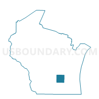
Outline

Summary
| Unique Area Identifier | 693342 |
| Name | LEROY - T 2 Voting District |
| County | Dodge County |
| State | Wisconsin |
| Area (square miles) | 29.84 |
| Land Area (square miles) | 28.60 |
| Water Area (square miles) | 1.25 |
| % of Land Area | 95.83 |
| % of Water Area | 4.17 |
| Latitude of the Internal Point | 43.58172790 |
| Longtitude of the Internal Point | -88.59218940 |
Maps


Graphs
Select a template below for downloading or customizing gragh for LEROY - T 2 Voting District, Dodge County, Wisconsin


Neighbors
Neighoring Voting District (by Name) Neighboring Voting District on the Map
- BURNETT - T 2 Voting District, Dodge County, WI
- CHESTER - T 1 Voting District, Dodge County, WI
- LEROY - T 1 Voting District, Dodge County, WI
- LOMIRA - T 2 Voting District, Dodge County, WI
- OAKFIELD - T 1 Voting District, Fond du Lac County, WI
- THERESA - T 1 Voting District, Dodge County, WI
- WAUPUN - T 1 Voting District, Fond du Lac County, WI
- WILLIAMSTOWN - T 1 Voting District, Dodge County, WI
Top 10 Neighboring County Subdivision (by Population) Neighboring County Subdivision on the Map
- Waupun town, Fond du Lac County, WI (1,375)
- Lomira town, Dodge County, WI (1,137)
- Theresa town, Dodge County, WI (1,075)
- Leroy town, Dodge County, WI (1,002)
- Burnett town, Dodge County, WI (904)
- Williamstown town, Dodge County, WI (755)
- Oakfield town, Fond du Lac County, WI (703)
- Chester town, Dodge County, WI (687)
Top 10 Neighboring Unified School District (by Population) Neighboring Unified School District on the Map
- Waupun School District, WI (18,859)
- Mayville School District, WI (8,013)
- Lomira School District, WI (6,748)
- Oakfield School District, WI (3,256)
Top 10 Neighboring State Legislative District Lower Chamber (by Population) Neighboring State Legislative District Lower Chamber on the Map
- Assembly District 53, WI (59,677)
- Assembly District 59, WI (58,836)
- Assembly District 39, WI (56,515)
Top 10 Neighboring State Legislative District Upper Chamber (by Population) Neighboring State Legislative District Upper Chamber on the Map
- State Senate District 20, WI (176,381)
- State Senate District 13, WI (175,277)
- State Senate District 18, WI (170,917)
Top 10 Neighboring 111th Congressional District (by Population) Neighboring 111th Congressional District on the Map
Top 10 Neighboring Census Tract (by Population) Neighboring Census Tract on the Map
- Census Tract 419, Fond du Lac County, WI (7,180)
- Census Tract 9601, Dodge County, WI (6,008)
- Census Tract 418, Fond du Lac County, WI (4,851)
- Census Tract 9602, Dodge County, WI (3,171)
Top 10 Neighboring 5-Digit ZIP Code Tabulation Area (by Population) Neighboring 5-Digit ZIP Code Tabulation Area on the Map
- 53963, WI (13,910)
- 53050, WI (6,986)
- 53048, WI (3,364)
- 53065, WI (2,226)
- 53006, WI (1,779)
- 53922, WI (1,036)